You’ve finished reading 48-State Odyssey and despite all my warnings, you’d like to know more. Perhaps you’d like to take a long road trip of your own, though if that book didn’t dissuade you, I don’t know what will.
Here you’ll find supplementary information that didn’t make it into the book, which was long enough already. I’ve listed preparations we made before, as well as how we did things during, the trip. I offer these thoughts for your consideration, but I’ll deny any claim to being an expert on road trips.
Why Did We Go?
During the eternal hours and endless days behind the dashboard, we pondered that question ourselves many times. Not out of casual curiosity, mind you, but more out of a general assessment of things, a weighing of alternatives. Economists call that “opportunity cost.” Did the reason we set out, however grandiose in conception, merit continuing the trip, now that the reality of it looked like 90% mind-numbing boredom and 10% life-threatening peril?
I blame my father.
He enjoyed traveling. The open road beckoned him and he often heeded the call, by car and more often by motorcycle. After retirement he journeyed a lot, but always driving to a destination, then home, as most people do. One day he emailed me, stating that he wanted to make a tour of the forty-eight contiguous states, and asked me to plan a route for him. He could have planned it himself as well or better than I did, but the task intrigued me. I’ll discuss that planning later.
I suggested a route to him. Time passed and he ventured out on many other trips. He never accomplished the forty-eight-state tour, though. During that time, I became interested in making the trip myself. Something about the wacky nature of it, the Jules Verne-like adventuring aspect, the fact that few had done it, appealed to me.
After mentioning it to Jean, I detected a lower level of eagerness on her part. Not the most empathetic of men, I find her hard to read sometimes. When she said, “Why on earth would we do that? No way!” I picked up a faint sense of mild reluctance.
As months and years passed, my arguments wore down her disinclination. Marriage involves occasional accommodations of your spouse’s crazy wishes and dreams. If one spouse, say the wife, asks the other, her husband, to empty the dishwasher every morning, and her husband asks her to accompany him on a forty-eight-state tour, together the two may find a way to call that an even trade. Or at least one of them may consider it even.
Jean assented to making the journey, but insisted on some rules. More on those later.
We began planning the trip in earnest. I retired in 2018 but one thing and another intervened, especially the COVID-19 pandemic, and we kept putting off the trip. When my father died in 2022 (not from COVID), the impetus to go grew stronger.
To sum up, we made the trip because of my dad’s idea, my growing passion for it, and Jean’s eventual consent to it.
Preparation
How should you prepare and pack for a forty-eight-state tour? The process differs from that of a normal road trip. For those, you know in advance the one or two destinations you’re aiming for and roughly how long the trip will take. Checking the weather in your departure and destination town allows you to pack appropriate clothes. You can make hotel reservations in advance, and even restaurant meal reservations.
If you’re intending a forty-eight-state tour, you must prepare for the unknown. You don’t really know how far you’ll get on any given day, so forget hotel and restaurant reservations. As for weather, forecasts lose accuracy beyond five days, so you’ll need to plan for a wide range of temperatures and precipitation. You’ll generally find cooler weather in the northern states and warmer weather in the southern ones, but not always. Pack clothes for both extremes, including boots and thick coats for snow, and shorts and short-sleeved shirts for hotter states. Sunscreen, too.
Regarding the amount of clothes to pack, that depends on how often you intend to wash them, not on the estimated length of the trip. Whether you plan on staying with friends and relatives and using their washer and dryer, or just washing clothes at a hotel, it makes sense to pack some detergent and fabric softener.
The variety of clothing types may force you to pack your largest suitcase. If you’re staying in hotels, use the available wheeled luggage carts (bellman’s carts) to tote stuff to and from your room. Another option—bring a smaller overnight suitcase with just the stuff you’ll need for one or two nights, then transfer dirty clothes from it, and clean clothes to it, with your main suitcase at the car the next morning. That way, you’re not lugging huge suitcases into and out of a hotel (or friend’s house) for a one-night stay.
Your car requires preparation, too. You and your car are going through it together and neither should let the other down. You’ll be putting it through a lot of wear and tear. Ensure the vehicle’s maintenance is up to date. If you take it in for servicing, consider telling your mechanic about your upcoming trip. The day before you go, top off the fluids. At intervals through the trip, check the oil. If you’ve paid for a towing service, find that phone number and make sure you can get to it if the time comes.
Aside from the known stuff, prepare for possible adversities. Your car could malfunction, even suffer a breakdown, and you might get stranded. Consider bringing an emergency car kit with strobes, flashlights, blankets, charging cables, hand tools, tire inflation pump, etc. I suggest keeping this kit in your car at all times, not just for 48-state tours. Prior to your long trip, go through that emergency kit and replace expired items. Remove batteries, bag them, and tape the bag to the electrical item. Bring extra batteries.
Other bad stuff to consider includes car theft and confrontations with criminals. Discourage car theft by covering the contents of your car with a blanket, parking in well-lit areas, and, of course, locking your car. As for criminals, consider bringing pepper spray. It’s legal in all states and requires no license. You might wish to practice using the spray device so you’re not fumbling with it in the tense moment of greatest need.
You might consider planning for the lesser, but still frustrating, misfortune of losing the cell signal. Printing your route on paper before you go might help you navigate through cellular dead zones.
Our Cars
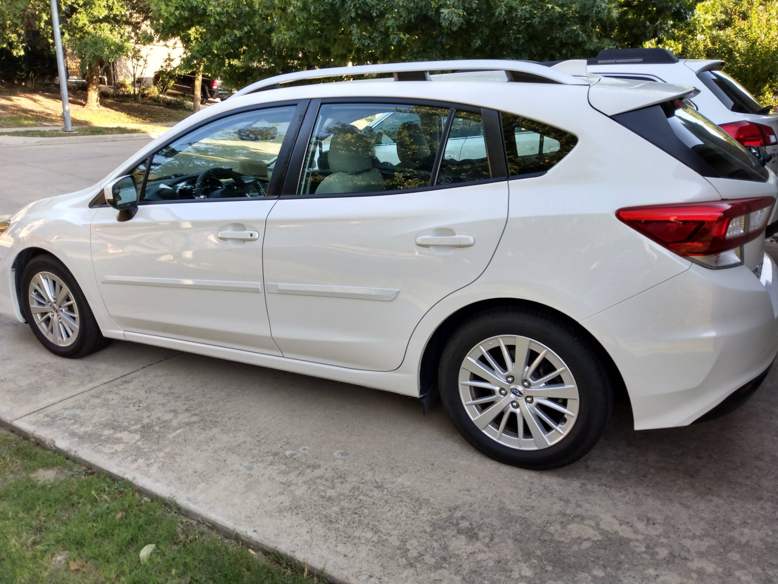
We drove two cars for the forty-eight-state trip, one on each loop. For the western loop, we used our newer vehicle, a 2017 Subaru Impreza, then six years old. A white car with a black interior, it always seemed small and cramped to my wife, but I liked the gas mileage. For the record, we averaged 33.5 miles per gallon on that loop.
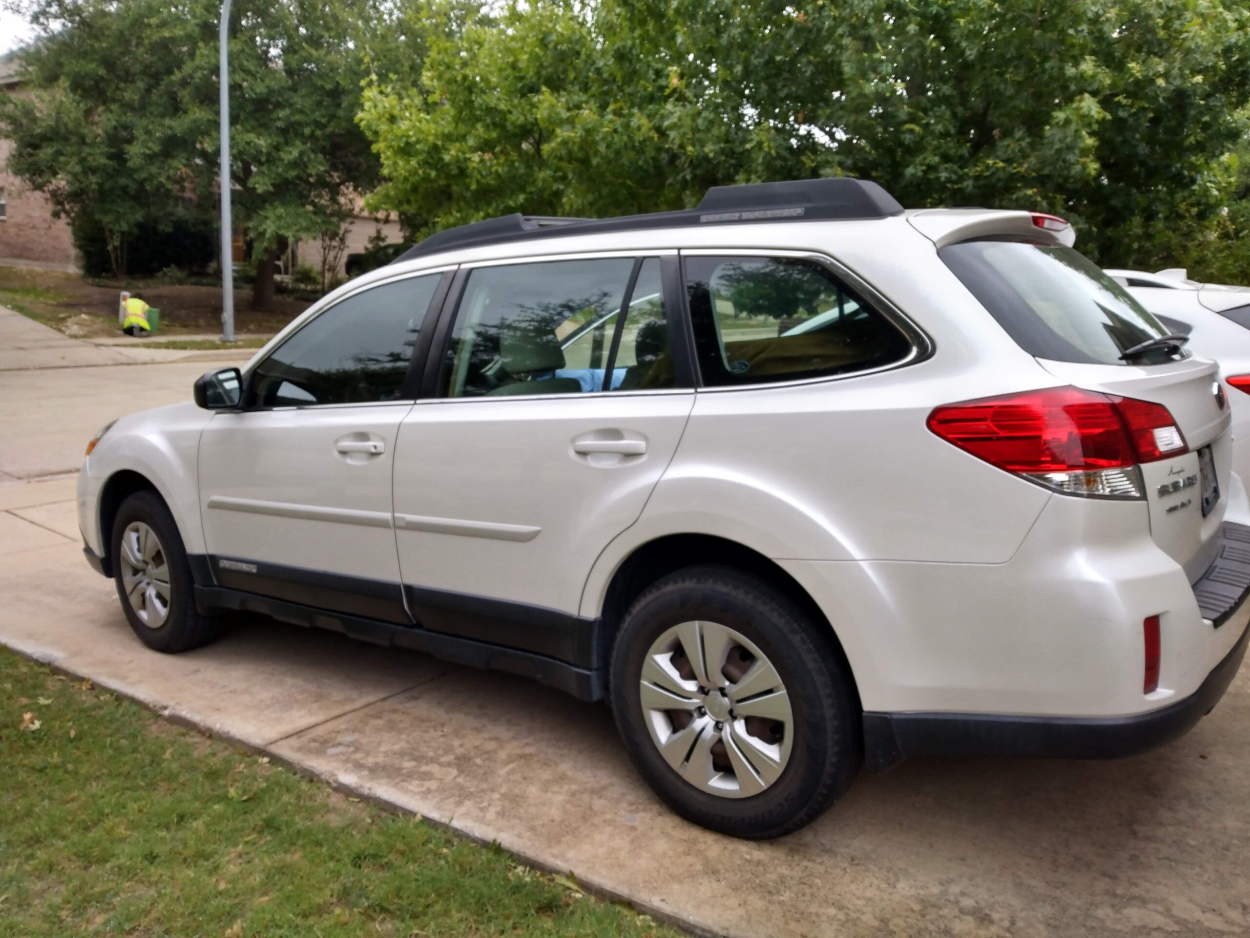
For the eastern loop, we drove our other car, a 2012 Subaru Outback, eleven years old. We’d taken good care of it and felt confident it could finish the trip. Also white, but with a tan interior, it provided more space for stuff and greater comfort. However, it only managed 29.3 miles per gallon on average.
Trip Rules
When my wife consented to make the trip with me, she wanted to know what kind of trip I envisioned. Would we aim to set a record for the fastest forty-eight-state trip, zipping around the country in less than a week? (As far as I know, the record is 106 hours and 43 minutes, set in 2008.) Would we spend time soaking in the ambiance of each state, taking months for an open-ended chance to visit tourist spots, national parks, staying with friends and relatives? Or would we let chance guide us, starting on a planned route, but feeling free to deviate if some roadside sign for ‘the world’s biggest’ this or that caught our eye?
Each of those, and more, represented valid ways of touching all contiguous states. Whatever we picked, she advised, we should commit to it, and not get pulled into some other mode.
After discussion, we settled on the following rules. We’d choose, in advance, a couple of tourist stops we’d never seen—Mount Rushmore and the Hoover Dam—and only stop for those. We’d move right along at a comfortable pace, neither pushing ourselves too hard nor dawdling in any place too long. Eight hours a day seemed a sustainable driving time. Though we know friends and relatives in many of the states, we decided against visiting more than a very few. We apologize to those we didn’t visit on this trip, and hope to see you another time.
I didn’t want to split the trip into two loops, but relented when I saw the wisdom of that for us. A week-long break in the middle would allow for resting, paying those bills we couldn’t handle online, and catching up on mail. Starting and stopping in a centrally-located state made that easier.
Route Planning
When my father considered making the trip himself, he asked me to plan the route. Find the shortest road route touching the forty-eight contiguous states, he said. It sounded like an interesting mathematical problem, the kind I like. After all, how long could it take?
A very long time, as it turns out.
Mathematicians call this type the “traveling salesman problem.” Given some fixed points, what is the shortest set of line segments connecting them all? If the country contained ten states or less, I’d find the problem trivial and could solve it by looking at a map. It appeared unlikely I could convince forty-eight state legislatures to consolidate boundaries and re-form into ten states for my convenience.
Even if we kept forty-eight contiguous states, but could reshape them, that would have helped. Imagine if the states formed a forty-eight-slice pizza pie, all narrow wedges converging at one central point. I could do a forty-eight-state tour by standing in one spot.
Once again, reality conspired against my desire for easy route planning. Out of plain stubbornness, the governments of those forty-eight states refused to change boundaries to accommodate a reasonable request. I had to accept the states as they were.
For countries with thirty states or more (that don’t all connect at one point), mathematicians call the traveling salesman problem “unsolvable in real time.” That means I could task world’s fastest computer to work on it and wouldn’t get the solution until the universe ends in billions of years.
Impatient by nature, I preferred not to wait that long. The sticking point lay in that “shortest route” clause. If you don’t mind driving a little more, the whole problem collapses to something a computer can solve in minutes.
What does “driving a little more” mean? The computer might yield a workable solution (say, 7000 miles) in the time it takes you to watch a cat video. If you allowed it to work for billions of years, it might provide a better solution shaving several inches off that distance. I don’t know about you, but that doesn’t seem worth the wait.
I did some searching online and found others had figured out and posted their 48-state routes. Choosing one of those, I emailed my dad. He didn’t end up making the trip after all, but he’d planted the yearning in me.
For the route my wife and I were to take, we added the complication of desiring two loops, and our country’s wide shape suggested a western loop and an eastern loop. The map software of internet search engines includes an ability to plan a road trip including up to ten points. However, you can’t just ask for a minimum distance route between two states. You must specify a geographical point, typically a city or town.
For the “perimeter” states—those bordering Canada, Mexico, the two oceans, and the gulf—the task of choosing a target city became trivial. We’d aim for points on their inner border, where they adjoin more interior states. No need to venture farther into the outer ones.
In time, I came up with what seemed a reasonable route. Not a mathematically least-distance route, of course, since the states and roads might not last several billion years, making the journey moot. But my route plan came out to about five thousand miles in each loop.
More About Route Planning
In the last section, I mentioned how search engine mapping software prefers to work with either geographical points (latitude and longitude) or cities and towns. For most of us, the “cities and towns” option works best. As I planned the route, I selected a town near a corner or edge of each state with the aim of reducing the distance as much as possible. These became my “target towns.”
Later, once I’d nailed down the overall route, I wondered where we might stay each night. I didn’t need to know specific hotels—we planned to leave things loose, not make reservations, and just look for clusters of competing hotels in the late afternoon. Still, I sought some notion of what city or town we might reach at the end of each day.
Estimating we’d cover about 300 miles a day, I came up with a list of “destination towns,” excluding huge metropolises. We wished to avoid rush-hour traffic. All of moderate size, these destination towns featured several chain hotels. It felt good to have prepared this list, knowing we could aim for a reasonable place each night.
In practice, the “destination town” concept fell apart. First, we got comfortable traveling more than 300 miles a day, so pushed past several destination towns while still full of energy. Second, Jean didn’t participate in any of the pre-trip route planning, preferring to trust me on that part. When in the car, though, she’d often ask, “Where are we going next?”
I did a poor job of explaining the difference between a target town and a destination town, and ended up confusing her. The destination town concept would have worked better if I’d known we’d average 471 miles on each driving day.
Getting Along with Your Companion
If you decide to become a 48er and to travel with someone else, choose your companion well. You’re going to be one yard away from that person for weeks or months, crammed in a small metal box.
Together you’ll make decisions about what to listen to, where to eat, where to sleep, where to stop for gas or bathroom breaks, what route to take, what sights to see, and many other things. Will the passenger be allowed to comment on the driver’s driving prowess? How and when will you switch drivers? Do the habits of one companion annoy the other?
When you disagree, (and you will), you can’t stomp off to another room and slam the door behind you. You’ll remain one yard apart.
I’ll offer one technique I’ve found helpful. Consider first the relationship you have with your traveling companion. Whatever that relationship is—friend, family, spouse, lover—keep that relationship in your mind at the moment of disagreement. Weigh the two things in your mind, the relationship on one side and the topic of disagreement on the other. Most often, the argument will fade to insignificance compared to the bond you have. Losing a minor dispute, or compromising on some middle path will seem far preferable to risking a disruption of the relationship.
Aim to finish the trip with your relationship as strong or stronger than it was at the beginning. You may find it necessary to cut the trip short to save the relationship. On a scale of the important things in life, our links to each other far exceed small things like road trips. Exploring human connectedness, that’s the true adventure.
Mountain Country
Several states feature mountains. They vary in type and appearance, from solitary rounded mounds to vast, steep-sided peaks standing in rows. Some appear velvety, with lush vegetation and others give a craggy, rocky appearance with snowy summits.
After you’ve driven across flat territory for hours or days, you’ll find your gaze drawn to a mountain appearing in the distance. It becomes a reference point impossible to ignore, a jutting reminder of how titanic geological forces beneath your feet result in towering undulations that appear to you as permanent. You’re witnessing a tidal wave in super-slow motion, so slow you can’t watch it moving, and can’t look away.
To me, the mountain ranges rose like the rim of some vast bowl. At times, I drove through long, flat valleys bordered by ranges on two sides. I dubbed these regions “bowl country.” Some highways crossed these valleys and I saw what the road-builders saw, a pass up ahead between peaks. Then we reached the foothills and the highway twisted and snaked to conform to the lowest and simplest route requiring the least effort and material to build. I’d have used the same thought process had I been forced to cross the range on foot.
At some point, (not always marked by a summit sign), the mountain highway leveled off and we began an exhilarating descent. The car’s engine no longer worked so hard, but the brake’s task worsened with the effort to keep from exceeding the speed limit.
While ascending and descending the steepest mountains on sinuous roads, I imagined myself in a James Bond movie, with bad guys shooting from pursuing cars or helicopters. My Subaru Impreza transformed into a well-equipped sports car that zipped at high speed around perilous curves, with the camera showing a breathtaking panorama of nature’s grandeur.
My mind’s eye pictured crazy scenes like that, but in reality, I drove in a safe manner. Still, even the least imaginative driver can’t ignore the picturesque beauty and splendor while looking down the slopes at the corrugations and rippling of the land, the peaceful valleys and the majestic massifs all around.
After the descent, you return to bowl country, leaving one mountain range behind, but often seeing a different one in the distance ahead. At times like these, I wondered what effect mountains imprint on people growing up in their presence. Raised in Iowa, I knew gentle, rounded hills, but no mountains.
For those raised in mountain country, where mighty ranges border their lives like gigantic bookends, do those high ridges serve as psychological comfort? How do those people feel when they travel to flat regions without a mountain in sight? Do they fear the backdrop to their lives has been torn away? Does it cause a vague unease, as if the Earth no longer holds them in its grasp and they might fall off?
A silly question, I know, but something about the solid, looming height of a mountain compels me to ask. Perhaps a similar psychological effect occurs for people growing up near an ocean’s coast. Maybe they perceive the world as half solid and half liquid and it feels right to live at the edge between the two. Without a large body of water nearby, those people might feel as if half their world had vanished.
Drive through mountain country yourself and then try to convince me you experienced no bizarre thoughts, no strange emotions from the experience. We may not move mountains, but they move us.
State Boundaries
I felt a sense of accomplishment when leaving one state and entering another. One more ticked off the list and another to explore (or at least set foot in). Welcome signs mark the border of each state on all significant highways, so you know when you pass from one to another.
Those signs say you’ve entered a region bearing a different flag, a different capital, different laws, and a different culture.
However, most often, everything looks the same on the side you entered as it did on the side you left. Had you not seen a sign, you’d have no idea you crossed a border.
Some borders make sense. When you cross a bridge over a river and see a state border sign, you know the river marks the border. On the map, it shows a squiggly line, the meandering path rivers make.
Other borders seem arbitrary. A surveyor drew a straight line and declared a border. Easy to draw on a map, but not based on any observable difference between State A and State B.
How many of our states include at least one straight border? All except Hawaii. How many states claim entirely straight borders? Three—Colorado, Utah, and Wyoming.
As far as I can tell, the border between Idaho and Montana stands as the only squiggly state border not determined by a river or coastline. Why did surveyors mark such a winding and sinuous border there? No evidence exists of drunkenness on their part, though I wouldn’t rule it out. More likely, they used mountain passes to mark that twisting line. Thus, if you ask which states lack a river or coastline boundary, you must add Montana to the three straight-line-border states mentioned earlier.
Borders often provide good locations for certain businesses. If State A declares a particular product illegal, you can bet a business offering that product will appear just over the line in State B.
Here’s my Law of Borders: the perceived significance of a border varies in proportion to a resident’s distance from it. That is, to those in the center of a state or country—particularly in the capital—the border takes on great importance. It separates their region’s upstanding citizens from the unfortunates residing in lesser lands. Those living near the border see things a different way. The border appears arbitrary to them. They often share more in common (through cultural and business ties) with those just over the border than with those in their own distant capital.
You can see this effect in a map of our country’s time zones. Time zones don’t always follow state boundaries. I suspect citizens at one edge of State A feel more connected to a large city across the border in State B than they do to the rest of State A. Therefore, they’d prefer to measure time as State B does.
If you’re going to have separate states, you have to draw lines somewhere. Arbitrary and meaningless, perhaps, but borders aren’t changing any time soon. We’re stuck with the boundary lines we have. As you travel state to state, things may look the same on both sides of any particular border, but as you drive farther in, you’ll start to see the different and distinct character of the state you entered.
Lunch on the Road
Two of our daily meals became routine early in the trip and remained the same. For breakfast, we ate at the hotel unless they didn’t provide a morning meal. In those rare cases, we’d grab breakfast at a fast-food place. For dinner, after a long day of driving, we enjoyed eating in a restaurant.
As for lunch, in the trip’s early days, we’d stop at a fast-food place. That seemed natural—a good break from driving. Soon, two problems emerged. First, sometimes we didn’t feel like stopping yet. Once in the groove, with a destination town still far along the road ahead, we wanted to keep moving. Second, we didn’t feel hungry enough for a full lunch. Here our reasons differed. Jean didn’t eat much anyway, and a full breakfast satisfied her until dinner. As for me, once my coffee thermos ran dry, I snacked as a method of staying alert.
Our lunch habit changed, and we chose between two options depending on our state of hunger. On days we felt like skipping lunch, we snacked from our stash of supplies. On days when we craved something more, we stopped at convenience stores and purchased ready-made sandwiches. We ate those on the road.
Regarding ready-made sandwiches, we chose from among the selections with care. I didn’t want stuff falling out of my sandwich while I ate behind the wheel. Jean always unwrapped the sandwiches for me and ensured I had a napkin on my lap. We always delayed eating until we got back on a major road with sparse traffic.
Where to Stay
On a long journey, you have to sleep sometime, and somewhere. If you plan to camp your way around forty-eight states, you must find a suitable campsite or other place to stay the night. Campers never worry about their bed—it’s either their own sleeping bag or bunk.
You might sleep in the homes of friends or relatives. They might not have chosen to live in the optimum part of the state for your route, but just seeing them provides a good reason to drive out of your way. Best to arrange these stays ahead of time, send occasional reminders, and text an estimated arrival time on the day of. Etiquette suggests you should provide a gift, and follow up with a thank-you.
Highway rest areas offer another option for sleeping, assuming the nearby highway noise doesn’t bother you. They lack showering facilities, but you can freshen up in the available bathroom. You can shower at truck stops (also known as travel centers) such as Love’s, Pilot, Flying J (the latter two now joined as one company), and TravelCenters of America (TA).
We chose to stay in hotels. Expensive, yes, but easy to find. During our trip, we stayed in eighteen hotels—nine in each loop. Since we stopped early, between 4:00 and 6:00 p.m. each day, and didn’t happen to land in a town with every hotel booked due to some major event, we always found a vacancy.
How do you choose the right hotel from among several in a cluster? I don’t know a foolproof method. As with restaurants, you might prefer one-off hotels with local ambiance. For consistency and known quality levels, you could opt for the national chains, which we did.
Online search engine maps and internet rating sites offer customer reviews and provide a hotel star rating system. From what I can tell, no standard system exists in the USA for hotel ratings, but five stars or diamonds always means a higher quality and cost than one. Customer reviews may help you decide, but a given hotel may have improved after receiving a bad review, or worsened after receiving a good one.
The major hotel chains offer reward programs to entice you to stay at their hotels on a consistent basis. They make it easy to join their program, and offer discounts for customers who stay enough nights in their hotels.
Many hotels also offer discounts for those in certain categories, such as being an AAA American Automobile Association) member, being an AARP (formerly the American Association of Retired Persons) member, being in the military or a veteran or a first responder, or being a senior citizen. If you belong in one or more of those categories, ask about discounts at the reception desk.
You have to remember to ask about discounts, though. Reception desk personnel don’t always offer them. By the time you’re standing there, tired after driving all day, delighted to find they have a vacancy, and looking forward to relaxing in the room, you’re ready to sign the form and pay the first price they name. Make it a habit to ask about discounts, if you’re eligible.
Modes of Travel
If the idea of a forty-eight-state tour intrigues you, I’m sorry for any role I might have played in firing that wayward neuron. I advise you to read a different book until the feeling goes away.
If the notion persists and you’re giving the matter serious thought, nothing I can write will dissuade you. Early in your planning, you’ll have to consider how you’ll travel. Jean and I went by car, but other options exist.
For those with more money than time, flying might work. You’ll face a challenge scheduling forty-seven short commercial flights, but it sounds like a wonderful adventure. If you’re a qualified pilot with access to a plane, even better. In 2023, John Skittone and Bob Reynolds set a Guiness World Record by flying and stopping in the 48 states in just 38 hours and 13 minutes. Yosuke Chatmaleerat completed the trip by helicopter in 12 days in 2017.
Trains and buses present slower and less expensive options, while leaving the driving to others. The Amtrak website shows train routes through all contiguous states except South Dakota and Wyoming, so you’d need to take a couple of side trips by other means to reach those.
Travel by car—as we did—seems the standard choice. However, I’m unaware if anyone’s made the trip by electric car yet. Perhaps you’ll be the first. One day, someone will go by self-driving car.
Taking a camper might appeal to you. Both John Steinbeck (Travels With Charley) and William Least Half-Moon (Blue Highways) drove campers on their trips, but neither of them hit all the contiguous states.
Motorcycle enthusiasts know only one way to go—on two wheels. Many have made the trip that way, some in just over five days. The Iron Butt Association (a real thing, you can bet your, um, butt) lists it as one of their challenges and provides rules to follow for certification purposes.
Scientists rate bicycles as among the most efficient ways to travel in terms of distance covered per energy expended. As a downside, you serve as the motor. In 2020, Keith Morical completed a forty-eight-state tour by bicycle in 31 days and 22 ½ hours, so you’d have to pedal fast to beat his record.
Perhaps you’re the sort who prefers more exotic transport. To my knowledge, nobody has yet completed the trip by pogo stick, skateboard, unicycle, scooter, hoverboard, or Segway™. Someone needs to be first, I suppose.
Who needs a vehicle? You could jog or walk your way through forty-eight states. Chris Englert, author of 50 Hikes. 50 States.: An American Adventure, hiked a trail in all 50 states in 24 months. I suspect she trekked through established, unconnected trails and used another form of transportation between them. I see no reason (aside from time, expense, lack of interest, dislike of hiking, etc.) why someone couldn’t travel by foot in a continuous loop through the contiguous states, though.
Rest Stops
Often, while driving, I’d see one of those blue signs announcing a rest area ahead and ask Jean if she needed to stop. How nice to pull over for a bathroom break without any advertising signs or implied pressure to buy something.
I’d like to thank the person who first thought of the rest area idea. I suspect a husband and wife embarked on a long road trip in their Model T about a century ago. Somewhere between distant towns, the man pulled over and stopped the car, then walked to a tree to urinate, in clear view of a farmer on a tractor. In that moment, I suspect, the woman tried to suppress a growing bladder pain and thought, “Wouldn’t it be nice if…?”
Today, about 1800 of these facilities enhance the U.S. Interstate system. Some, designated Welcome Centers, appear within a few miles after entering a state’s border. Although rest areas share common attributes, I suspect nobody imposed any firm standards on layouts or construction. As a result, many states give their rest areas a local flair through their architecture and inside décor.
They vary, too, in cleanliness and available facilities. Regarding the below-average ones, I understand it costs money to keep them sanitary, restocked with supplies, and upgraded with modern amenities. Some rest areas feature low-grade hand driers—just blowing on my hands would double the drying speed. Those state legislators facing budgetary pressures should keep in mind that road travelers may form a first impression of your state from the condition of the first rest area. I’m looking at you, Nevada.
On Route 140 in northern Nevada, a sign informed us about an upcoming rest area and we looked forward to the break. Pulling into the parking lot, we saw a tiny building just big enough to contain two doors, with pit toilets behind each one. A desert outhouse. It won our award for Worst Rest Area of the trip, without much competition. Better than no rest area, but not by much. In fairness, Route 140 lacks the prestige of an interstate, but still deserves a better rest stop.
Hotel Safety
You’d never spend the night in an unfamiliar building full of strangers, any one of whom might be a pyromaniac, Peeping Tom, or thief, would you? Yes. Every night you stay in a hotel, you’re doing that, and paying for the privilege.
Chances are, you’ll never experience a safety problem in a hotel. During our trip, we stayed in eighteen different hotels without a single incident. Even so, it may ease your mind to take simple precautions.
- If you can, park near a light. If you arrive during daylight, you might not remember to do that, since the sun illuminates the whole place. But that parking lot will look different at night. No sense making your vehicle the most tempting one.
- If you leave valuables in your vehicle, hide them, lock the vehicle, and check door handles to ensure the locks engaged.
- After check-in, when you reach your room, glance down the hall both ways. Where’s the nearest exit or stairway? Imagine it’s 2:00 a.m. and smoke fills the hall. At that moment, you’d rather not have to guess the quickest way out.
- Cover the door’s peephole. If you need it later, you can uncover it.
- Clip the window curtains closed. In some hotels, the curtains don’t close all the way, allowing a sliver of a view from the outside. My wife used a binder clip. Upper floor windows might not worry you as much, but sickos can operate camera drones.
- When you go out for dinner or for refueling the car, leave the TV on. Not super loud, but just enough to be heard through the door. This might discourage a thief.
- If you must leave valuables in the room when you go out, lock them in the room safe, if one is available. At the very least, hide them so they’re not in plain sight.
- While inside the room, engage the door latch and deadbolt.
Most likely, you’ll never experience a problem in a hotel. Still, you’re better off taking these precautions and not needing them than wishing you had.
Interstates
If you’re planning a fast-paced forty-eight state tour by road, your route will include interstate highways. You could call the system by its full name, the Dwight D. Eisenhower National System of Interstate and Defense Highways, but by the time you’ve said all that, you’ve missed your exit. Most people shorten that to the Interstate Highway System.
The standardized signs and road layouts ease your way and lessen the chance of confusion. The design of the freeways allows for high speeds and rapid transit between major cities.
Not everyone adores the system. In his book Blue Highways, author William Least Heat-Moon derides that standardization as bland sameness. For him, the interstates bypass and ignore the most interesting small towns. Interstate travelers thus miss the colorful uniqueness of each of our country’s regions.
He makes a good point. If you set aside several months for your journey and wish to immerse yourself in the essence and culture of each state, then stay clear of interstates and choose the lesser roads.
People dislike the system for other reasons, too. Most stretches of interstate don’t afford scenic views. Also, during the system’s construction, the government displaced a million people, most of them low-income citizens. Some of the highways divided towns and cities in a way that cleaved neighborhoods by race. The system cost a lot of money, too—over $600 billion when adjusted for inflation. What could taxpayers have done with their money had the system not been built?
Still, despite these downsides, the system exists for our use. For speed, convenience, and simplicity, interstates represent a fine way to move around the country by car.
Vision versus Actuality
Before embarking on a road-trip, it appears in your mind as an exciting adventure, non-stop fun. A few hours into it, however, a tedious dreariness sets in.
There’s the road ahead, separating left from right, ground from sky. Always the road, only the road. A strip of concrete marked with white and yellow lines, leading to infinity. As time slumps on, you realize you’ve been rumbling along the road forever, and you’re destined to remain there, always rolling along without end.
No “there” awaits you at some future terminus, only an eternal “here.” What you mistook for a line connecting one place to another really forms a loop without beginning or end.
Out of the thousands of exciting and interesting things you could have chosen to do with your finite time on the planet, you selected to drive a car between nowhere and no-place. And you’ll never get there. You’re on an automotive hamster wheel, but without the physical benefit of exercise.
None of that sprang to mind during your trip planning phase. What happened to the adventure, the fun you’d imagined? Maybe someone else took that vacation and left you to take this one.
But the feeling doesn’t really last forever. Distance still equals speed multiplied by time, and none of those factors equal infinity, at least for us mortals. You will reach a destination. Except for beltways, highways do not stretch in loops—they connect to towns and cities. It just seems like eternity.
That depressing sense of going nowhere, of standing still, while a straight, global highway rotates with the planet beneath you—that melancholic ennui may hit you on any lengthy road trip. But a 48er gets more accustomed to it, like I expect long haul truckers do. However, at least truckers get paid for it. For 48ers, money flows the other way.
When the boring reality of the road displaces the fun-filled pre-trip vision, you need something to sustain you so you won’t quit. Some distraction, like music, audiobooks, or conversation with a passenger. Something to help time pass faster.
Yes, ours is a big country. Even so, with help, you can get through it.
Tipping Hotel Housekeeping Staff
Each morning, before leaving a hotel, we left a cash tip on the dresser in front of the TV. For a one-night stay, (almost all our stays on this trip), we left $3 to $5. We stayed three nights at the hotel in Cedar Rapids, and left one larger tip the last morning before checking out.
The American Hotel & Lodging Association suggests tipping $1-to-$5 per day (more for luxury hotels), so we met that standard. However, we should have left the tip each day, not just the last day of our stay.
When you tip restaurant waiters, you engage with them face to face and see them working. By contrast, you might never meet hotel housekeeping personnel or see them at all, and thus might forget to leave a tip. They do work hard, and tips make up a significant part of their income.
Tip in cash. Some people no longer carry cash, but, for tips, you should. If you find only large bills in your wallet, you can get change at the lobby desk.
State Flags
Every state, large and small, requires a piece of cloth to wave in the wind. Unlike a windmill or boat sail, a flag produces no output and accomplishes no work. Still, colors and symbols carry meaning, and every state craves a piece of that action. People pour a great deal of time and thought into flag design, and vexillologists even study flags. By the way, vexillology gets its name either from the Latin word for banner or from how vexing these flag scientists can seem to others. Take your pick.
Most state flags adhere to the same pattern. Citizens slapped the state seal onto a monochrome background, the “seal on a bedsheet” method. Whether they acted from laziness, a lack of creativity, or an urge to follow precedent, nobody knows. One thing’s certain—few state legislatures bothered to read the principles of good flag design. Those are (1) Keep it simple, (2) Use meaningful symbolism, (3) Use 2 or 3 basic colors, (4) Avoid lettering or seals, and (5) Be distinctive or be related.
A 2001 survey rated the New Mexico flag as best-designed, and the 1956 flag of Georgia as the worst. In response, Georgia mobilized their national guard to attack the study’s authors. Oops, no. That’s not true. In response, the Georgia legislature changed the state flag, but still thumbed their nose at the study by flouting flag design principles 1, 3, and 4 for their new flag.
If you place each state’s flag in its place on a map of the country (hours of fun for the whole family), you’ll notice an interesting phenomenon. Well, a phenomenon, anyway. The color blue dominates in the northwest states, while the color red dominates in the southeast. Draw your own profound meaning from that.
Jean considers Maryland’s flag the prettiest. By a quirk of happenstance, she grew up in that state, but would never let a mere accident of residence influence her aesthetic judgement. Though I see her point, I’m put off by that flag’s origins in royalty. Didn’t we fight a war to get rid of kings? Also, Maryland’s flag violates principles 1 and 3.
Well-designed or not, state flags give citizens something to be proud of, and we all need that. As an added benefit, the flapping of a nearby flag might just shoo some pesky insects and birds away.
Gasoline Tank Strategy
Jean maintains an odd habit—she always refills her car’s gas tank when the fuel gauge reaches the half-way point. She claims it keeps her from running out of gas. I tell her she goes to the gas station twice as often as everyone else.
Once, I asked her what she thought the bottom half of the gas tank was for. (Note to automotive experts—I know the outlet lies at the tank’s bottom. Don’t write to correct me, just go with it.)
In yet another marital compromise, we do things Jean’s way. It just became a habit for me, too. True, I’ve never run out of gas, but I bet I’ve visited twice as many gas stations as you have.
We adhered to this policy on our trip, for the most part. In addition, Jean liked to fill the tank at the end of each day. That way, when we got going the next morning, we could proceed without having to think about filling up for a while.
Where should you stop for gas? Here’s my theory: given a choice of places, I prefer areas with two or more gas stations close to each other. That way (again, in theory) competition will keep the price low. I’ve never performed a study to test that theory, or seen someone else’s study on the subject, so my hypothesis may be, as scientists say, all wet.
On occasion, my theory clashed with Jean’s habit. We passed a few exits that lacked sufficient gas station competition, even though our gauge drifted below halfway. Still, driving on the top half of the tank allows plenty of margin if you drive longer than you expect to.
Avoiding Metropolis
Throughout the trip, we sought to stay clear of big cities. Nothing personal, and no slight intended against people who live in them. But traffic congestion in the asphalt jungles really slows travelers like us.
For some reason, road planners must hate 48ers. If you look at a highway map, you’ll see it’s as if they laid out highways for the sole purpose of driving from one big city to another.
Often, when in a merciful mood, they included beltways around cities, and we used those when we could. But beltways add miles to the trip, and sometimes get just as crowded and slow as the mid-city routes.
For two thousand years, people have said, “all roads lead to Rome.” It began as a literal phrase before taking on its figurative meaning of having multiple ways to get something done. But it sure must have been a problem, even back then, if you didn’t want to go to Rome.
Farms, Ranches, and the Farmasaurus
While taking a road trip, if you didn’t know better, you’d guess American citizens do nothing more than farming and ranching. You’ll drive by a lot of farms and ranches. In reality, the country’s two million farmers make up less than one percent of the population, and they provide food for us all. The 48 states’ 877 million acres of farmland consume about half the entire area of those states.
Despite growing up in a farming state, I know less about farming or ranching than the average city-dweller. Other than corn, I can’t tell one grain crop from another, nor identify breeds of cattle. I suspect the presence of fences indicates a ranch, since crops rarely wander away when left to themselves, but I’m not certain of that.
Don’t mistake ignorance for ingratitude. I’m thankful to all farmers and ranchers for their hard work. I marvel that the wonders of technology and free enterprise improved crop yields over the centuries to the point where so few can feed so many.
Permit me one fanciful side comment. A machine dominates modern crop farms, a device I never saw in my youth. This metal monstrosity stretches a hundred yards or more in length. Spindly in appearance, the device’s metal framework rests on intermittent triangular wheeled supports. You’ve seen them. I’m guessing farmers use them for irrigation.
But with their arched upper tube resembling a long backbone, and long dangling rods resembling ribs, and the angled supports looking like legs, and the jutting end resembling a slender head, I began visualizing them as strange animals. I dubbed these creatures farmasauruses.
We saw various specimens of the farmasaurus in almost every state. They spend most of their day at rest. I never saw one on the move and I count myself lucky. They must walk, though, and reproduce somehow, for you see them everywhere. They lead solitary lives, it appears, for I never saw more than one in a field. Their presence on crop farms implies an herbivorous diet. Still, I never witnessed one feeding, so I can’t be certain a farmasaurus won’t eat you if given a chance.
Give these beasts a wide berth and keep a wary eye on them as you drive by.
Audiobooks
While we drove on our actual adventure, we enjoyed many literary adventures, thanks to audiobooks. In a way, Jean and I explored several new worlds at once.
Prior to starting on the first loop, the western loop, I downloaded several audiobooks on my cellphone. I used the Libby application, which allowed me to check out audiobooks from a library. Our 2017 Subaru Impreza connected to my phone and enabled listening to the books through the car’s speakers, so long as we maintained a connection to cellular towers.
For the second, or eastern loop, we traveled in our 2012 Subaru Outback, which couldn’t connect to phones, but boasted a compact disc player. During that portion of the trip, we listened to audiobooks on CD.
Jean and I differed in our audio tastes. She preferred listening to music and got bored by narrators’ voices droning on. I preferred audiobooks, whether fiction or nonfiction. Jean thought it best not to play an audiobook as we passed through major cities at heavy traffic times. Between these facts and the occasional loss of cell signal, we only completed six audiobooks during our trip, though that six included one eighteen-hour tome—Blue Highways by William Least Half-Moon.
Our driving time for the trip came to 185 hours, and the 6 audiobooks only consumed 45 of those hours. In theory, we could have listened to 4 times as many books.
You may prefer music, podcasts, radio talk-shows, conversations with your travel partner, or the near-silence of road noise. Give me audiobooks and I’ll drive happy.
Eating
If you go on a 48-state trip, you’ll notice hunger setting in at some point. Best to plan for that in advance. You could bring pre-purchased food with you in a cooler and supplement the stock from grocery stores along the way. You could eat at the homes of friends or family. In theory, you could hunt for game and pick edible plants you find, though most would consider that a non-preferred option.
Jean and I chose to eat breakfast at each hotel, eat lunch while driving—usually a sandwich or other snack—and have dinner in a restaurant.
Years ago, my brother-in-law developed a method of classifying eateries, and I find it useful:
Tier 1: homemade dinner at the home of family or friends
Tier 2: one-off restaurant, such as a food truck or local restaurant with one location
Tier 3: multi-location, limited area restaurant, often with local ambiance
Tier 4: regional chain restaurants from outside your home area
Tier 5: national chain restaurants
With my brother-in-law’s preference for new and unique food experiences, he called these “tiers” because he favored those with lower numbers. He considered Tier 5 his “gotta eat somewhere” last resort. His classification schema ignores food quality. You can get good or bad food, healthy or unhealthy food in any of the tiers.
I share my brother-in-law’s taste for unusual, new food experiences, and would have sought the niche, non-touristy places where locals eat—Tiers 2 and 3. Jean prefers the food of dependable, consistent quality you receive in Tiers 4 and 5.
Marriage being a give-and-take arrangement, we compromised by eating wherever Jean chose.
In total, we spent $1,206.10 on food, including $119.57 in tips. In restaurants, we tipped between 15 and 20%, but we purchased much of our lunch and snacking food in convenience stores where we didn’t tip. The western loop of our trip accounted for only about 1/3 of that total, but it lasted 9 days compared to the eastern loop’s 15.
Staying Awake
On a 48-state tour, you’ll encounter long periods of monotonous sameness. Endless lines on the highway stretching into the distance, endless skies, endless farms or other dull scenery. You’ll sit in the same position for hours, with the hum of engine and wheel noise lulling you. What a great recipe for sleepiness.
According to Wikipedia, 250,000 people a day fall asleep while driving in the United States. Studies show (and a Mythbusters TV show episode corroborates) driving while drowsy puts you in more danger than driving with a blood alcohol content above the legal limit.
Techniques I used to stay awake on this trip included: (1) getting enough sleep each night, (2) being consistent about sleep periods, aligning with circadian rhythm, (3) sipping from my coffee tumbler only every five minutes, (4) nibbling on snacks in moderation, (5) listening to interesting audiobooks, and (6) pulling into rest areas every few hours. Jean stayed alert for any signs of my fatigue, and asked me every now and then if I were okay.
If you make a similar trip, find your own techniques. Mine may not work for you. Some people sing along with songs on the radio. Others do simple math problems in their heads, especially involving average speed (miles driven divided by time).
Find a place to pull over if you feel fatigue coming on. Even a twenty-minute nap can refresh you enough to continue your journey.
Bonding
If you’re fortunate enough to take a road trip with a loved one, especially an extended vacation, you may find yourself enjoying more than the surrounding scenery. The experience expands into something more than two people learning about new places. Recent studies show trips can enhance and deepen personal relationships. You might set out to tour the country and end up touring the facets of your bond with another person.
Early in their marriage, one of our daughters hiked the Appalachian Trail with her husband. Their trek consumed six months, most of it alone in the wilderness with each other. Aside from the adventure of it, they benefited from the opportunities for long conversations, a rare thing for most youthful couples. Perhaps they intended to get closer to nature, but they also got closer to each other.
Our 48-state trip lasted only a few weeks and involved sitting in a car rather than a grueling 2200-mile hike. Further, 43 years had elapsed in our marriage already so we knew each other well. Even so, this shared journey strengthened our commitment and nurtured our already-deep love.
However, the various calamities we endured kept testing that bond.
Route Deviations
A 48er starts with a route plan. However, as Robert Burns reminds us, “The best-laid schemes o’ mice an’ men/Gang aft agley.” That could translate as “let mice plan your trip, because the gangplank’s back aft” or “plans often go awry.” I’m unsure which.
In Montana, our plan showed us traveling on westbound Interstate 94, then exiting to Interstate 90 in Billings. Prior to reaching Billings, Google Maps warned us of a problem on I-90 and suggested we cut north on Montana Highway 3, then west on U.S. Route 12, then back south on some road to reconnect with I-90. Google never specified the problem, but we obeyed her authoritative voice.
Once on Route 12 (named the Lewis and Clark Highway because the L&C expedition never went anywhere near it), we saw no need to turn south to regain I-90 (as Google recommended) because, near Butte, the interstate would curve north to meet us. Instead we stayed on 12, past where it joined U.S. 287 in Townsend, continued through Helena and re-joined I-90W at Garrison.
Later, during our eastern loop, Jean had become more accustomed to analyzing and commenting on my planned route. Based on her long familiarity with the New England area, she disliked my notion of nipping off the northwest corner of Rhode Island using minor roads, then cutting through the middle of Connecticut through Hartford and Danbury. Better and faster, she said, to push further into Rhode Island, take the beltway (I-295) around Providence, and follow I-95 along the southern coast of Connecticut.
Before the trip, I’d spent many hours planning the route, minimizing traveling distance, keeping to the inside of the outer states. However, I’d spent no time consulting with Jean, who knew the Maryland-to-Rhode Island area backwards and forwards. (She may well have driven it backwards, for all I know.)
Without hesitation (well, maybe a little), I bowed to her expertise. Though my planned route avoided both oceans, our trip through Connecticut allowed us to see the Atlantic on our left. It marked the only excursion to an oceanic coast on our trip.
I don’t count our later route through Georgia and Florida as a deviation, since I planned for two contingencies. When a visit to a friend in New Smyrna Beach got canceled, we shifted to Plan B.
Yes, a plan can go agley. When it does, follow the principle of Semper Gumby. Romans might gag at that Latin, but the phrase means “always be flexible.”
Healthy or Convenient?
If you eat healthy at home, you may find it difficult to sustain that dietary habit when traveling. Fast food signs will attract your eye and beckon you into quick and easy drive-throughs, just at the moment hunger kicks in.
You can maintain your health-food regimen while on the road, but it requires effort and willpower. You’ll sacrifice the convenience of typical roadside eateries. Instead, you’ll stock up in grocery stores, or dedicated health-food stores, if you can find them. Bring a cooler for foods requiring refrigeration. Preparation of heated foods might prove difficult unless your hotel room includes a microwave.
Did Jean and I eat healthy on our trip? No. We opted for convenience at almost every turn. Sometimes we selected the healthier choices from the hotel breakfast offerings. Sometimes we ordered salads at dinner. For the most part, though, we chowed down on the sort of prepackaged junk that haunts every dietician’s nightmares.
As humans, we’re burdened with unfortunate food cravings. We desire fat, sugar, and salt, the very things that harm us when consumed in excess. Now, for the first time in human history, we’ve honed food delivery systems to provide us with great quantities of unhealthy food at low prices, everywhere we go.
Only five or six generations ago, our forebears hunted for meat and hand-picked fruit and vegetables. Travel for them meant eating off the land, and starving if they couldn’t get enough. Now we suffer a problem they couldn’t have imagined—saying no when food gets shoved at us every few miles.
Don’t get me wrong. I wouldn’t switch places with those that came before me. I’d prefer to suffer from the modern problem of plentiful, tasty, low-cost food.
In short, if you undertake a forty-eight-state tour, you’ll face a binary choice between health and convenience. Pick one.
Conversations with Strangers
While on a typical road trip, most interactions with strangers center around transactions—checking into a hotel, ordering food, buying sundries, etc. Sometimes, while waiting in line or in an elevator, idle conversations occur. Outgoing, friendly people sometimes ask where you’re headed. That presents a problem for 48ers.
How do you answer the question? Give them the next state on your list? Tell them you’re headed home the long way?
Faced with this at one point, we said we’re visiting the forty-eight contiguous states. This caused eyebrows to raise, but we then asked where they were going, and they preferred to talk about that. I’m guessing they wondered about our sanity and hoped not to catch some contagious affliction.
The danger of contagion exists, of course. I caught the idea of a forty-eight-state trip from my father at his mere mention of the concept. A natural immunity protects most people, though. Only spirited, adventurous types, people prone to fits of wanderlust—perhaps one percent of the population—need worry about catching it.
Do I regret exposing those unsuspecting people who’d been riding in an elevator with me? No. Chances are, they’ll never make the trip themselves. Even if they do, little harm can come of it.
No doubt, this book does far more to spread the odd infliction than a few random encounters, but I won’t apologize for writing it.
Why Only 48?
Readers in Alaska and Hawaii might feel offended that our trip, and this book, didn’t include their states. I apologize. Driving to Alaska requires a passport and traversing a long stretch of Canada. They haven’t finished the bridge to Hawaii yet. On past occasions, I’ve traveled to each of your wonderful states, but for this trip we stuck with the contiguous ones.
At times, I’m sure, Alaskans and Hawaiians feel a sense of detachment and remoteness from the rest of the country. Whether that brings subsequent sensations of sadness or happiness may depend on whether they want something from the country or not.
Despite the non-contiguous and distant nature of those states, the rest of the country loves Alaska and Hawaii. Together they summed our total to a nice, round number of fifty.
I assure those in The Last Frontier and The Aloha State that your states’ omissions from my book didn’t arise from animosity or ill will. Your territory may not adjoin the others, but you’re connected to us in the ways that count.
Weather, or Not?
For the most part, we enjoyed good weather throughout both loops of our trip. I attribute this to the animal sacrifices we offered to the weather gods each night. Well, not sacrifices, exactly, though we often ate meat at dinner. Now that I think about it, we didn’t invoke the names of any weather gods, or even know any, except for Zeus and Thor. After further consideration, I attribute all the fair weather to dumb luck.
Making our trip in September and October, we ran a risk of encountering hurricanes, even early snowstorms, with an outside chance of tornadoes, hail, frost, dust devils, ball lightning, or volcanic eruptions. Instead, we hit rain and thin fog on a few occasions, nothing worse.
As mentioned earlier, we did our best to prepare for the worst by packing emergency gear and checking it before leaving. We didn’t need any of it, but better to have and not need than need to have and never have a need. Something like that.
Should any readers be tempted to plan a forty-eight-state trip, I hope you come to your senses before leaving. Failing that, I wish you good weather. That’s the best I’ve got. As wise men from Charles Dudley Warner to Mark Twain to Willard Scott have said, “Everyone complains about the weather, but nobody does anything about it.”
The Allure of the Unvisited
Some folks suffer from wanderlust and the rest say they don’t. When we read or see descriptions of far-off places, we imagine ourselves there. The grass seems greener, the air clearer, the sights grander, out in that wondrous locale beyond the rainbow.
The impulse varies in strength from person to person, of course. Some jetsetters keep bags packed at all times, ready to go at the least excuse. Some dedicated homebodies loath to step out of their front door. But even those in the latter group have to admit they sometimes think about traveling. Maybe fear, finances, or poor health keeps them from journeying, but I bet they go adventuring in their minds.
Wanderlust pulls some, and pushes others. For the former, something about the unknown ignites their passions. They yearn to confront new challenges, experience different cultures, and broaden their mental horizons. For the latter, when home and daily life turn stale, they ache to get away, to be elsewhere. For them, anywhere far away suffices.
Archaeologists characterize most of human history as nomadic. We didn’t settle on farms or build cities until recent times. The itch to move on to more favorable areas lies deep within.
Psychologists say we seek the new and abhor getting bored. Our minds light up when we encounter a fresh idea or novel surroundings. One area of our brain dedicates itself to jolting us with dopamine when we sense something beyond our previous experience. We become dissatisfied with the familiar, the monotonous, the humdrum, and we do anything to avoid it.
Biologists say evolution favored our most curious and adventurous ancestors. They gained experience and knowledge, learned by exploring, and helped their tribes and our species by maintaining a childlike curiosity about new places and things. They passed that trait to us.
Whatever the reason, you have to admit you feel it. It’s in there. The urge to go. You’re an animal built to move, to travel. The unknown beckons and you can’t ignore it forever.
I know—earlier I tried to dissuade you from traveling. I’ve reconsidered. Since you’re unlikely to encounter the crazy creatures and curious characters we did, I now advise you to obey that urge to wander. Go.
Further Reading
There’s no way to experience someone else’s vacation, but a skilled writer can get readers pretty close. Here’s a list of enjoyable travel books.
The Lost Continent: Travels in Small-Town America by Bill Bryson. One of the best travel writers of our day, Bryson takes readers on a 38-state road trip in search of the perfect small town. “Perfect” turns out to be a problematic standard for rating small towns.
Contiguous 48 USA by Chris Dyer. This twenty-five-year-old author took a trip much like the one my wife and I did. Dyer drove alone, staying with friends and relatives along the way. The book includes helpful guidance for others planning a similar journey, including packing and safety tips. As a young man, he saw more stadiums and bars, played more basketball, and jogged more than Jean and I did.
Better Than Fiction–True Travel Stories from Great Fiction Writers, edited by Don George. When fiction writers pen non-fictional accounts of their travels, readers get enjoyable tales. This book includes stories by many authors, some of whom traveled to exotic locations. Each drew deep meanings from their journeys and pondered the human drive to roam.
Harry and Tonto by Josh Greenfeld and Paul Mazursky. This novel differs from others in this list because the main character, Harry, disliked traveling. At seventy-two, he preferred to stay with his cat, Tonto, in his New York City apartment. After being evicted, he sought a place to live and ended up roving around the country and meeting strange people.
Blue Highways by William Least Half-Moon. Sticking to the lesser roads, and towns with unusual names, Least Half-Moon camped his way around the country in a travel trailer. He immersed himself in the vibe of each burg and painted a picture of small-town America with all its regional quirks.
On the Road by Jack Kerouac. A young man’s fictionalized account of real journeys across America in the late 1940s and early 1950s, this book helped define the beat movement. Less about places than people, the book provides a feel for travel in that era—the low prices, the safety of hitchhiking, and the use of “travel bureaus”—the Lyfts and Ubers of that time.
Free Air by Sinclair Lewis. Though fictional, this novel portrays, in a vivid way, the challenges of road trips in the early days of automobiles and paved roads, around the time of World War I. Picture cars with running boards and hand-crank starters. The book mentions long-defunct car manufacturers like Crane-Simplex, Locomobile, Mercer, and Pierce-Arrow. Drivers often dealt with tire punctures, dry distributors, fouled spark plugs, and worn steering-gear keys.
Travels With Charley by John Steinbeck. Few other travelogues about road trips compare with this. In 1960, a man and his poodle took a camper across much of the country in search of the soul of the nation. He groused about the changes during his lifetime to a faster-paced, blander and standardized type of nation, but also extolled the virtues of getting lost in it.
Roughing It by Mark Twain. The title carries a separate meaning today. Twain spun a partly true yarn about the hardships of travel by stagecoach compared to the comfort of trains. Today, we’d regard a trip pulled by those 19th Century steam engines, too, as “roughing it.” Though written in a now-outdated style, Twain still delights, and his wit sparkles from a century and a half ago to us.
The Will of an Eccentric by Jules Verne. One of Verne’s lesser-known novels, it classifies as pure fiction. A wealthy eccentric from Chicago bequeaths his fortune to one of seven contestants chosen by lot. Imagine the Candyland game, but each square on the path represents a U.S. city. The contestants travel to randomly chosen cities and the first to finish the game wins the fortune. The book highlights Verne’s love of America and his wit.
Assassination Vacation by Sarah Vowell. I challenge you to find a quirkier, snarkier travel book. The author, who voiced the character Violet in the movie The Incredibles, chose to visit all the sites associated with presidential assassinations. Why? Perhaps because no one else had done so, or wanted to. If she sought a rhyming title, she could have done a circumnavigation vacation, or a train station vacation, or a hundred other things. Still, it’s a witty book written about a macabre subject, and nobody will write another like it.