When I appear at conventions or other events, I like to display 3D printed models depicting vehicles or other objects from my stories. These help, I hope, attract potential readers’ eyes.
I’m pleased to announce the addition of a new item to my collection.
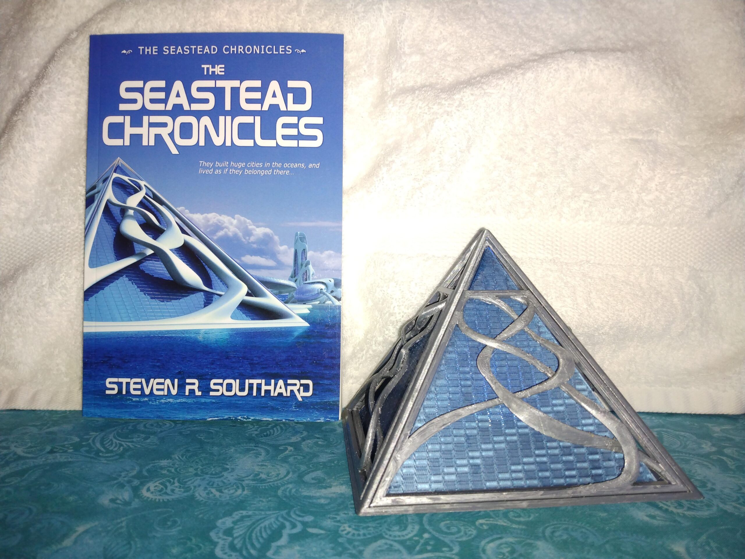
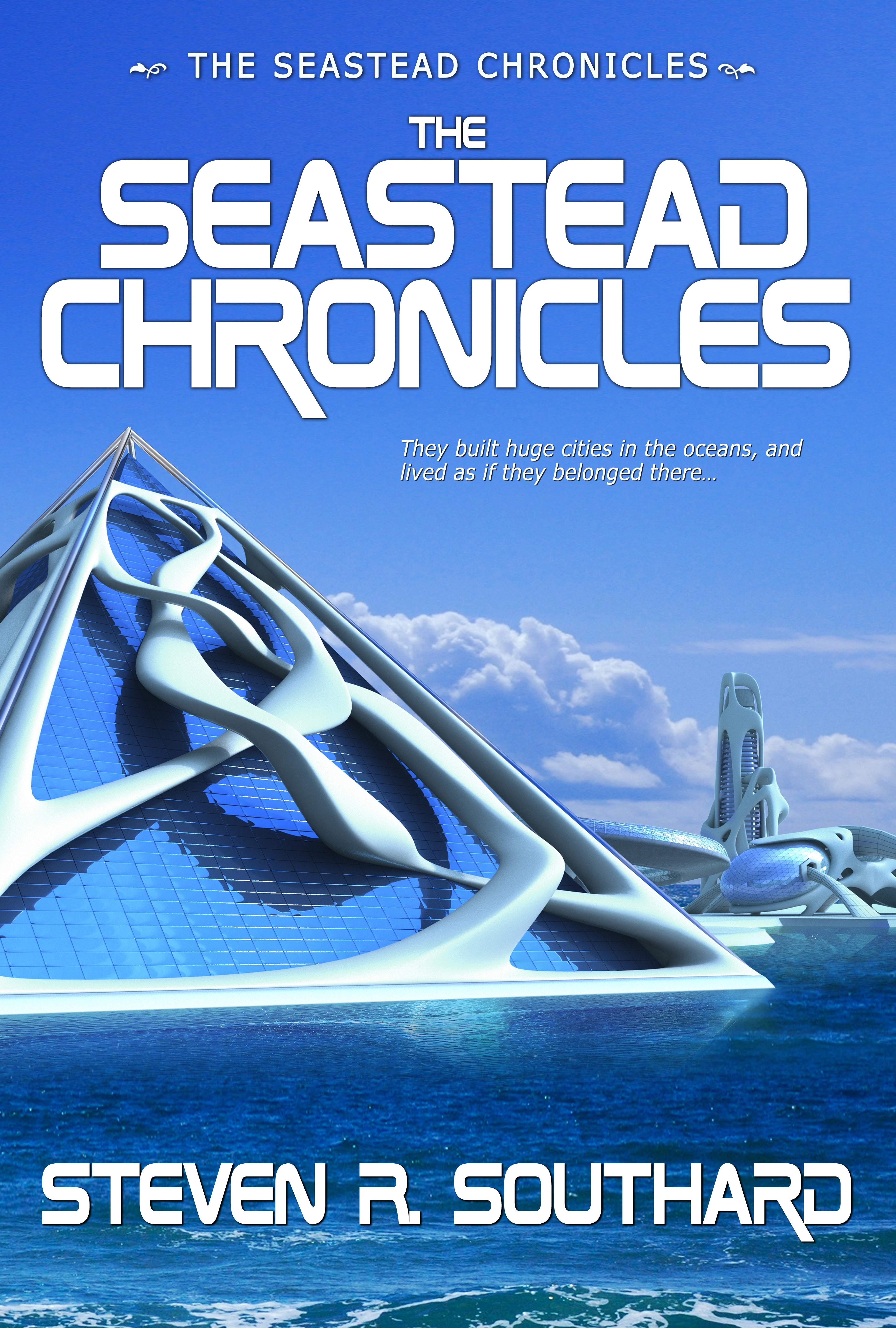
Behold the pyramidal seastead from the cover of The Seastead Chronicles! My publisher, Pole to Pole Publishing, used a cover image designed by an artist known as 3000ad.
I engaged the services of a 3D-printing designer named Duane Corpe to create a 3D version of that pyramid. Not only did he produce a wonderful model, but he made it big enough that I can put a puck light inside and make the pyramid glow.
The odd shapes on the outside of the pyramid proved a difficult challenge. Much of 3D printing design involves combining existing shapes first developed by others. For the sinuous, over- and under-lapping features you see on the pyramid’s outer surface, no previous models existed. I don’t know how Duane did it, but he created a fantastic display piece!
Search on the internet for “seasteads” and you’ll soon see mentions of billionaires and libertarians. Why is that? Are seasteads only for people in those small groups? Let’s explore the question.
I believe billionaires get mentioned with seasteads for two reasons: (1) Seasteads cost much more to build than houses on land, and (2) Billionaires often chafe at paying high taxes in their home country and long to escape to a low-tax country, of which few exist.
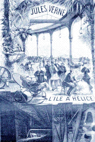
Among the earliest fictional examples of seasteads was Standard Island, a floating, mobile seastead in Propeller Island (or L’Île à hélice) by Jules Verne (1895). American millionaires built it.
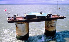
In real life, seasteads might not require billionaires at all. Settlers might construct a small one without spending vast sums. They might build on an existing, abandoned platform, as with the Principality of Sealand. Crowdfunding might present another way to pay for a seastead’s construction, with perks of citizenship offered in exchange for contributions.
Libertarians
Seasteading often gets associated with libertarianism because adherents to that political philosophy see few, if any, land nations living up to libertarian principles. Their efforts to influence one or more existing countries to adopt libertarianism have failed. Some now believe the only way to live in a libertarian country is to create a new one.
However, nothing about the seastead concept requires a libertarian governing philosophy. If you build a seastead, declare it a country, and somehow get it recognized as such, you could set up any form of government you please.
The Seastead Chronicles
In my book, The Seastead Chronicles, a brash billionaire builds a seastead and declares ownership of a sector of the ocean. I don’t state the type of government on that seastead, so readers may imagine what they wish.
The fate of that seastead initiates a “gold rush” for oceanic oil and minerals, boom, and other seasteads get established. Most of these locate near known ocean bottom resources to take advantage of seabed mining. They divide the oceans into nations, called aquastates, which other nations and the U.N. recognize. As with land nations, territorial disputes arise, some leading to war. A few aquastates go bankrupt and get absorbed.
Only one story in The Seastead Chronicles mentions the building of a seastead and I gloss over its funding. My stories depict seasteads as existing structures, since my aim is to imagine the effect on people of living at sea. Billionaires might have been involved in funding some of the seasteads, but others might have been built by corporations or crowdfunding.
As for governing systems, they run the gamut. I assumed people would flee their home countries and establish the government they dreamed of at sea. Given a fresh start, they’d set up their own planned utopias. A few might lean libertarian, or start off that way, but I imagined others as solarpunk, anarchic, monarchic, military oligarchic, cooperatively leaderless self-governing, etc.
Up to You
If seastead cities and their aquastates got established in real life, how do you think it would happen? Would only the super-wealthy fund their construction? Would libertarianism dominate their governing philosophies? You might enjoy letting your imagination conjure cities and countries at sea. You could come up with ideas even more outlandish (pun intended) than those of—
Isn’t it fun when a fiction book includes a map? If you’re like me, you linger over the map longer than you do any other page of the story. A map draws you in and makes you feel like you’re there, like you could use it to navigate from any spot to any other. As you read the story, you keep referring to the map to pinpoint the current action.
Maps of Others’ Stories
Sarah Laskow wrote a marvelous post about maps associated with fiction. Her article includes maps from The Swiss Family Robinson by Johann David Wyss, Walden; or, Life in the Woods by Henry David Thoreau, Treasure Island, by Robert Louis Stevenson, and others. Laskow discusses the reasons fiction writers make maps and their delight in drawing them.
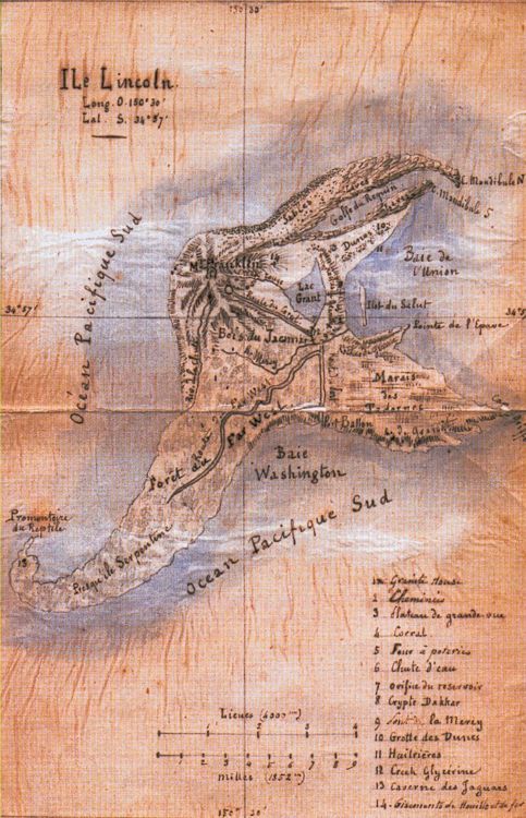
Lincoln Island, from Jules Verne’s The Mysterious Island
Lincoln Island
Readers of this blog know I adore Jules Verne, so I couldn’t resist mentioning the map of Lincoln Island included in his book, The Mysterious Island. His characters explored every extent of it, and named the significant features as well as the island itself. You can’t help but follow along with the castaways by flipping back to the map to see where they are.
Map of The Seastead Chronicles
While writing my book, The Seastead Chronicles, I made a map to keep things straight. However, I did not include that map in the book.
The stories in the book take place in our near future as people colonize the seas. As they’ve done on land, they carve out nations with borders, but call the oceanic countries “aquastates,” and people cluster in cities, called seasteads.
On my map, I refrained from noting seastead locations. Unlike cities on land, some seasteads can move, though others are anchored in place. One or more aquastates consist of a single, mobile seastead that travels the world (or at least, wherever it can get permission to go).
Problems with Mapping Aquastates
Borders between aquastates need not consist of lines marking vertical planes, as they do on land. In one case, a single aquastate overlaps another and their borders in that region cut horizontally, with a depth separation. Two-dimensional maps don’t show that situation well.
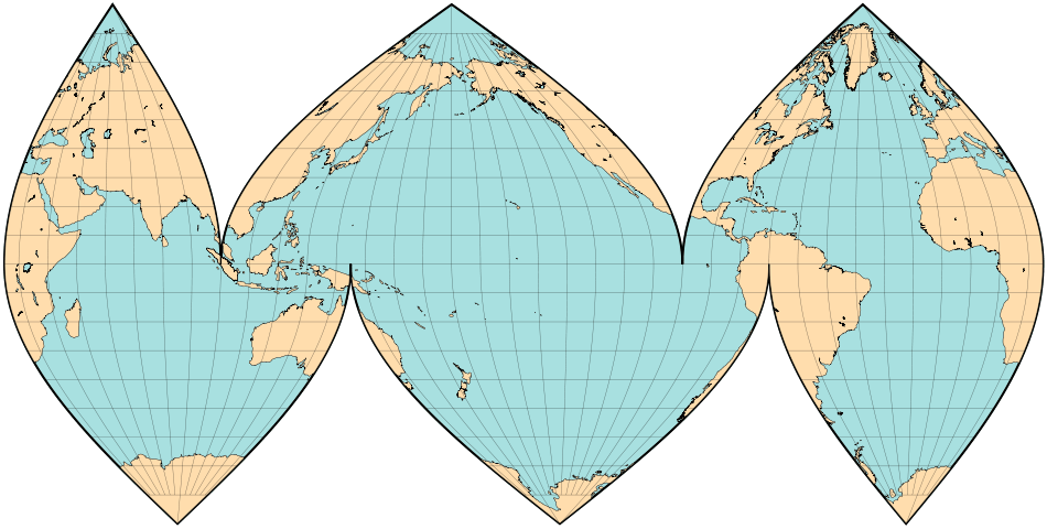
I faced another problem—map projections. Most world maps emphasize land, since that’s where people live…today. However, you can slice the orange other ways, to emphasize the oceans. Therefore, I based my aquastate map on what’s called the Interrupted Goode Homolosine Oceanic View. That map projection carves through land masses so you can focus on the water.
Interrupted Goode Homolosine Oceanic View
Another difficulty lay in the fact that The Seastead Chronicles spans a period of almost a century. No single map would suffice for that entire time, due to the varying number, shape, and area of aquastates over the decades. In the early years, people set up lone aquastates with no neighbors. Then the water got more crowded. As more people migrated to the oceans, some aquastates failed and collapsed while others grew and spread. Near the year 2100, I supposed, things might stabilize when the cost of war or legal disputes exceeded the benefit to be gained from additional territory.
Want to See It?
Are you curious about what my aquastate map looks like? I’m not ready to release it to readers yet, but I will sometime soon. Sorry about the cruel tease, but some things must wait until all is in readiness for—